The East African Rift System (EARS) is Earth’s most spectacular active continental rift. Spanning over 3,000 km from the Afar Triangle in Ethiopia to the Mozambique border, it’s tearing the African Plate into two—Somalia drifting east, the rest westward. This tectonic drama drives volcanoes, earthquakes, lakes, and vast sedimentary basins rich in oil and minerals.
New data sharpens the picture. For instance, 2025 seismic imaging reveals 25 km crustal thinning beneath Turkana Depression East African Rift highlights extreme crustal extension in the northern arm.
Quick Breakdown: EARS in 5 Key Points
• Length and Scope: 3,000+ km north-south, two main branches—Western (Albertine, Tanganyika) and Eastern (Gregory, Kivu).
• Age: Started ~30–35 million years ago, accelerating recently.
• Driving Forces: Mantle plume upwelling plus plate boundary stresses.
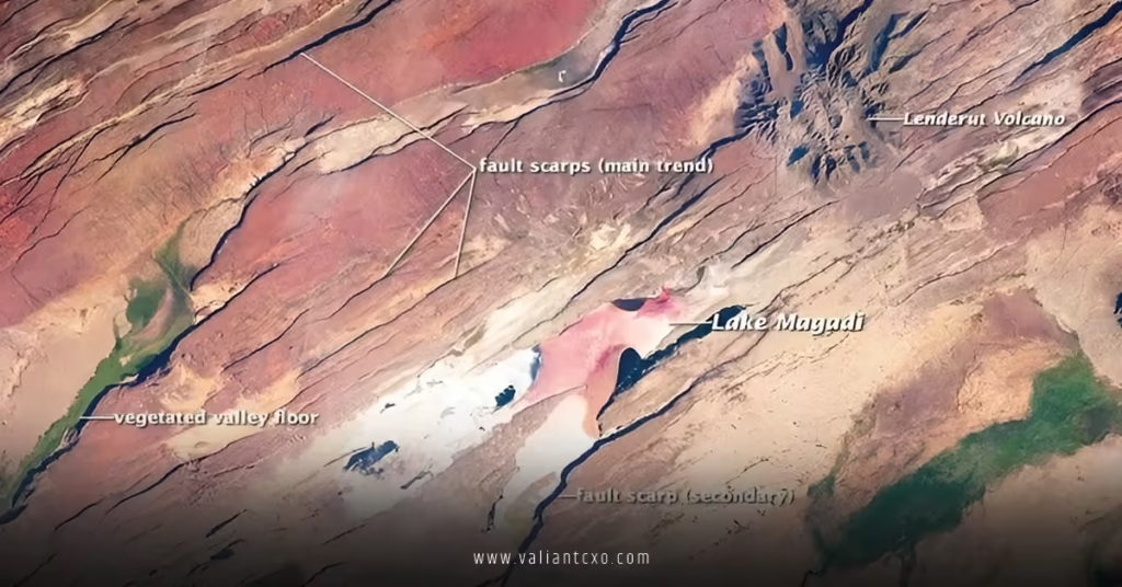
• Surface Features: Rift valleys, escarpments, volcanoes (Kilimanjaro, Ol Doinyo Lengai), soda lakes (Natron, Magadi).
• Human Impact: Hosts 150+ million people; key for geothermal power and fossil sites (Olduvai Gorge).
The Tectonic Setup: Why Africa Is Rifting
Africa sits smack in the middle of the Indo-Atlantic plate circuit. Most plates converge or slide past each other. Not here. The African Plate is being pulled apart from within.
Mantle dynamics kick it off. A massive plume rises beneath Ethiopia, thinning the lithosphere and generating heat. This upwelling drags the surface apart. Far-field stresses from the Red Sea and Gulf of Aden spreading centers add torque.
The result? Two rift branches. The Eastern Rift hugs the Tanzanian craton edge, while the Western dives into the Congo Basin. They meet at the Afar Triple Junction, where the Arabian Plate joins the party.
Extension rates? 4–8 mm/year, measured precisely by GPS. That’s slow for us, but continents move at a snail’s pace anyway.
Crustal Architecture: Layers and Faults Exposed
Rift geology boils down to extension. Normal faults slice the brittle upper crust. Below, ductile lower crust flows.
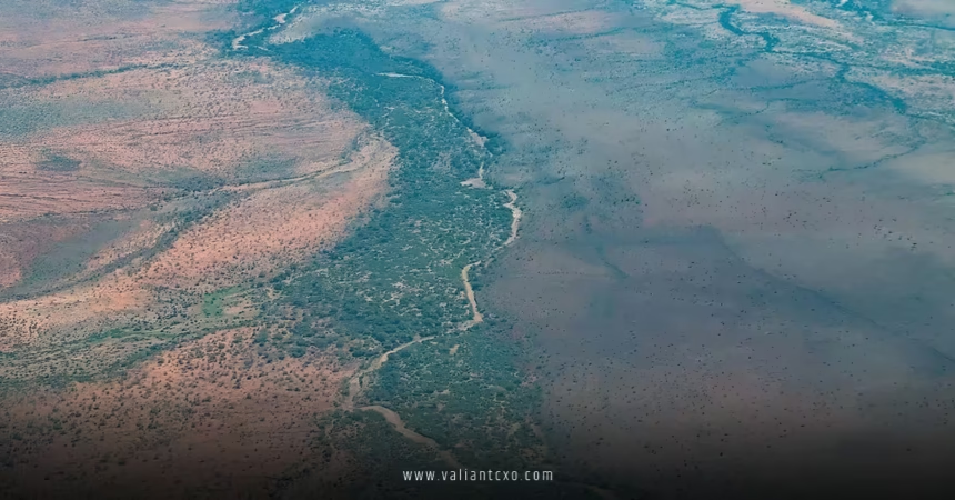
Upper crust (0–15 km): Faulted blocks, tilted and rotated. Sedimentary basins fill with lakes, rivers, volcanics. Think Lake Tanganyika—deepest freshwater lake on Earth, fault-controlled.
Lower crust (15–35 km): Thinning dramatically. Magma intrudes, underplating the base. Velocity models show this—high velocities indicate mafic intrusions.
Mantle lithosphere: Even thinner, 50–100 km vs. 150+ km in stable shields. Asthenosphere wells up, bringing heat.
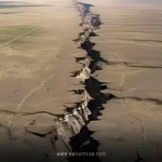
Faults dominate tectonics. Border faults define rift shoulders—steep escarpments rising 1–2 km. Intra-rift faults create horsts (uplifts) and grabens (down-drops). The Turkana Depression exemplifies this, with its basin-and-range style.
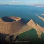
Volcanism: The Fiery Side of Rifting
No rift without volcanoes. EARS hosts 50+ active ones.
Alkaline volcanism rules. Low silica, high alkalis—think carbonatites at Ol Doinyo Lengai (the only active carbonatite volcano). Magma sources? Partial melting of metasomatized mantle.
Timing: Pre-rift (50 Ma), syn-rift (30 Ma–present). Flood basalts in Ethiopia mark the start.
Volcanic provinces align with rift segments. Silali Caldera in Kenya’s Gregory Rift; Virunga volcanoes (Nyiragongo) in the Kivu segment.
Tectonics controls it all. Faults feed magma to surface. Extension thins crust, dropping pressure and triggering melts.
Sedimentary Basins: Economic Goldmines
Rifts make basins. EARS has dozens—some of the world’s best hydrocarbon plays.
Basin Evolution:
- Syn-rift phase: Coarse clastics from fault scarps.
- Sag phase: Lacustrine shales, rich in organics.
- Post-rift: If extension stops, thermal subsidence deepens basins.
Standouts:
- Lokichar Basin (Turkana): Recent oil giants (Tullow, Total).
- Albertine Graben: Uganda’s oil frontier.
- Tanganyika Basin: Gas potential.
Minerals too. Soda ash from lakes; gemstones (tanzanite) in Merelani; rare earths tied to carbonatites.
Comparison: EARS Segments at a Glance
| Segment | Length (km) | Extension Rate (mm/yr) | Key Features | Volcanic Activity | Economic Highlights |
|---|---|---|---|---|---|
| Afar (Northern) | 500 | 15–20 | Triple junction, Danakil Depression | High (Erta Ale) | Potash, salt |
| Main Ethiopian | 800 | 6–10 | Flood basalts, Afar plume | Extreme | Hydrocarbons, geothermal |
| Kenya (Gregory) | 700 | 5–7 | Turkana Depression | Moderate (Silali) | Oil (Lokichar) |
| Tanganyika | 600 | 4–6 | Deep lake, border faults | Low-moderate | Gas, fisheries |
| Malawi | 800 | 3–5 | Youngest, narrowest | Low (Rungwe) | Coal, uranium prospects |
Step-by-Step: Mapping EARS Tectonics for Beginners
Step 1: Grab a base map. Use Google Earth or USGS overlays. Trace the rift scarps—linear features cutting across topography.
Step 2: Overlay GPS vectors. Arrows show extension direction. Western branch pulls southwest; eastern northeast.
Step 3: Add seismic profiles. Look for Moho depth contours. Shallower under rifts = thinning.
Step 4: Plot volcanoes and earthquakes. Clusters align with segments. USGS earthquake catalog is gold here.
Step 5: Integrate gravity data. Bouguer anomalies reveal crustal thickness—negative lows over thinned zones.
Step 6: Model it. Free tools like MOVE or GPlates let you simulate extension.
Common Pitfalls in EARS Interpretation & Fixes
Pitfall 1: Treating EARS as a single uniform rift.
It’s not. Segments differ in age, width, volcanism. Fix: Segment-specific models. Northern EARS is “hotter,” more magmatic; southern cooler, amagmatic.
Pitfall 2: Ignoring oblique extension.
Rifts aren’t always perpendicular to opening direction. Obliquity creates flower structures, strike-slip components. Fix: Use finite strain models; GPS proves it.
Pitfall 3: Overhyping plume dominance.
Plumes help, but plate stresses matter. Fix: Combine tomography (plume images) with plate reconstructions.
Pitfall 4: Neglecting paleo-features.
Inherited basement fabrics control fault patterns. Fix: Integrate aeromagnetics with modern tectonics.
Seismicity and Hazards: Living on the Edge
EARS shakes regularly. Magnitude 6–7 quakes hit every few decades (e.g., 1928 Subukia M6.8).
Style: Normal faulting dominates, strike-slip subordinate. Focal mechanisms confirm extension.
Why hazardous? Dense populations in valleys. Nairobi sits atop rift flank faults.
Mitigation: Microzonation using crustal models. Thin crust amplifies shaking.
Volcanic risks too. Nyiragongo’s 2021 eruption killed dozens.
Global Context: Lessons from EARS
EARS is the type example for juvenile rifts. Compare to Baikal (Siberia)—similar age, less volcanism. Or Rhine Graben—failed rift.
It teaches: Rifts can propagate, jump, die. Ocean basins start here.
For the US? Analogous to Basin and Range—extensional tectonics with economic upside.
Key Takeaways
• EARS is splitting Africa into Nubian and Somalian plates at 4–8 mm/year.
• Two branches: Eastern (volcanic, narrow) vs. Western (wide, lakes).
• Crust thins dramatically—down to 20 km in places, driving magmatism and basins.
• Economic powerhouse: Oil, gas, geothermal, minerals abound in rift basins.
• Volcanoes galore—alkaline suites from mantle melting.
• Seismic active: Normal faulting, moderate quakes.
• Study it right: Integrate GPS, seismics, gravity for full picture.
• Future? New ocean in 10–50 million years.
Grab the latest data. Start with USGS rift maps. If you’re exploring or researching, cross-reference with high-res crustal studies like those from Turkana.
Sources
• U.S. Geological Survey — African Rift Valleys
• Nature Geoscience — East African Rift Dynamics
• Geophysical Research Letters — GPS Measurements EARS
FAQs
Q: What’s the main driver of East African Rift system geology and tectonics?
Mantle plume beneath Afar plus far-field plate forces. Tomography images the plume; GPS measures the pull-apart.
Q: How does volcanism tie into East African Rift system geology and tectonics?
Extension thins crust, lowers pressure, melts mantle. Alkaline magmas rise along faults—explaining the 50+ volcanoes.
Q: Are there oil opportunities in East African Rift system geology and tectonics?
Absolutely. Rift basins like Lokichar hold billions of barrels. Syn-rift sediments provide source, reservoir, seal.