Tropical Storm Dexter has entered the 2025 Atlantic hurricane season, stirring up attention with its heavy rainfall and potential for disruption. Whether you’re in Florida, Louisiana, or anywhere along the Gulf Coast, this storm’s path and impacts are critical to understand. As of August 4, 2025, Dexter is making waves in the subtropical Atlantic, but its earlier journey as Invest 93L already soaked parts of the U.S. Gulf Coast.
Tropical Storm Dexter 2025: Current Status and Path
Tropical Storm Dexter officially formed on August 3, 2025, several hundred miles off the North Carolina coast, as reported by the National Hurricane Center (NHC) and WBRZ. Here’s where things stand as of August 4, 2025, at 10:21 AM IST (12:51 AM EDT):
- Current Status: Dexter became a tropical storm at 10 p.m. EDT on August 3, with maximum sustained winds of 45 mph. Located about 300 miles from Bermuda, it’s moving east-northeast at 10–15 mph, embedded in mid-latitude westerly flow. The storm is producing gale-force winds but is not expected to intensify into a hurricane due to increasing wind shear and cooler Atlantic waters (around 70–75°F). The NHC forecasts Dexter to become post-tropical by midweek, around August 6–7, 2025, and it poses no threat to land in its current phase.
- Path Outlook: Dexter is moving away from the U.S. coast over the western Atlantic, with no projected landfall. Global models suggest it could become extratropical by day 4 (August 7) and be absorbed by a front by day 5 (August 8), though there’s uncertainty in long-term forecasts.
Earlier Impacts as Invest 93L (July 2025)
Before becoming Tropical Storm Dexter, the system was tracked as Invest 93L in mid-July 2025, causing significant rainfall and flooding risks across the U.S. Gulf Coast. Here’s a recap of its earlier impacts:
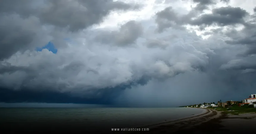
- Florida (July 15–16): Invest 93L crossed the Florida Peninsula on July 15, bringing heavy rain (4–7 inches, with up to 10 inches in areas like Tampa and Plant City) and localized flash flooding. Central and South Florida saw the worst impacts, with a Level 1–2 flood risk (out of 4) and dangerous rip currents along the Atlantic coast. The system’s disorganization, described as “a plate of scrambled eggs” by meteorologist Dylan Federico, limited its development over land.
- Gulf Coast (July 16–18): After reaching the Gulf of Mexico on July 16, Invest 93L had a 40% chance of becoming a tropical depression or Tropical Storm Dexter, fueled by warm Gulf waters (87–90°F). It made landfall in southeastern Louisiana on July 17–18, delivering 4–8 inches of rain across southern Louisiana (including Baton Rouge and New Orleans), southwestern Mississippi, and eastern Texas. New Orleans opened sandbag distribution sites to combat a Level 2–3 flood risk. Despite a 30% chance of cyclone formation by July 17, wind shear and land interaction prevented it from becoming a named storm at the time.
Key Impacts and Concerns
Tropical Storm Dexter’s impacts in July as Invest 93L were significant, and while its current path spares the U.S., here are the key concerns from its earlier phase:
- Heavy Rainfall and Flooding: The system dumped 3–6 inches of rain across the north-central Gulf Coast, with isolated totals of 6–10 inches in Louisiana, triggering flood watches in multiple parishes. Low-lying and urban areas faced the highest flash flooding risks, particularly in New Orleans and Baton Rouge.
- Travel and Safety Risks: In July, Florida saw travel delays, rough surf, and rip currents along the Alabama and Florida Panhandle coasts. Coastal Louisiana faced similar hazards, with the NHC warning of dangerous conditions through July 18.
- Agricultural and Water Management: While Dexter’s rains posed short-term flooding risks, they offered drought relief in Gulf states facing moderate to severe drought. Water managers adjusted reservoir levels to balance flood control and water storage.
2025 Hurricane Season Context
Dexter is the fourth named storm of the 2025 Atlantic hurricane season, following Andrea, Barry, and Chantal. The season, running from June 1 to November 30, has been quieter than expected, with NOAA’s initial forecast of 13–19 named storms revised to a “slightly above normal” 16. Chantal’s deadly flooding in North Carolina (killing an 83-year-old woman) highlighted the risks of even non-hurricane systems. Dexter’s formation aligns with historical averages, as the fourth named storm typically arrives around August 15.
The NHC is also monitoring another system (AL95) off North Carolina, with a high chance of becoming Tropical Storm Emilie, but it’s moving away from land. August typically sees a steep increase in tropical activity, so stay vigilant!
How to Prepare for Tropical Storms
Even though Dexter currently poses no threat, its July impacts underscore the need for preparedness. Here’s how U.S. residents, especially along the Gulf Coast, can stay ready:
- Stay Informed: Follow NHC advisories (www.nhc.noaa.gov), NOAA, and local weather services like WBRZ or KPRC Click2Houston. Sign up for weather alerts via text for real-time updates.
- Build an Emergency Kit: Stock up on water, non-perishable food, flashlights, batteries, and first-aid supplies for at least 72 hours. Include important documents in waterproof containers.
- Secure Your Home: Move valuables above 20 inches from the floor and 20 feet from your home’s perimeter to minimize flood damage. Use sandbags in flood-prone areas like New Orleans.
- Plan Evacuation Routes: Know your local evacuation routes and have a plan for pets. Don’t wait until the last minute to leave if a stronger storm approaches.
- Business Continuity: Business owners should develop a continuity plan, coordinating with local officials to protect assets and employees.
- Monitor X for Updates: Follow #TropicalUpdate or meteorologists like @DylanFedericoWX or @ReedTimmerUSA on X for real-time insights and community sentiment.
Why Tropical Storm Dexter Matters
Tropical Storm Dexter may not be a hurricane, but its July impacts as Invest 93L showed how quickly heavy rain can disrupt lives. From flooded streets in Florida to sandbag lines in New Orleans, Dexter reminded Gulf Coast residents to stay prepared. The 2025 hurricane season is heating up, and with warm Gulf waters fueling potential storms, every system counts. By staying informed and ready, you can protect your family and property from the next big weather event.
Final Thoughts
Tropical Storm Dexter 2025 is a wake-up call for U.S. Gulf Coast residents, even as it moves harmlessly over the Atlantic as of August 4, 2025. Its earlier path as Invest 93L brought heavy rain and flooding risks to Florida, Louisiana, and beyond, proving that even disorganized systems can pack a punch. Don’t let the next storm catch you off guard—follow NHC updates, prep your emergency kit, and stay alert for systems like AL95 that could become Tropical Storm Emilie. Whether you’re in New Orleans or Houston, now’s the time to get ready. Share your storm prep tips or experiences in the comments below, and let’s keep safety first!
For More!!!valiantcxo.com